L6896 : County Mayo - Achill Island - Portnahally / Ashliem Bay Viewpoint
taken 11 years ago, 3 km from Dooega, Achill, Co Mayo, Ireland
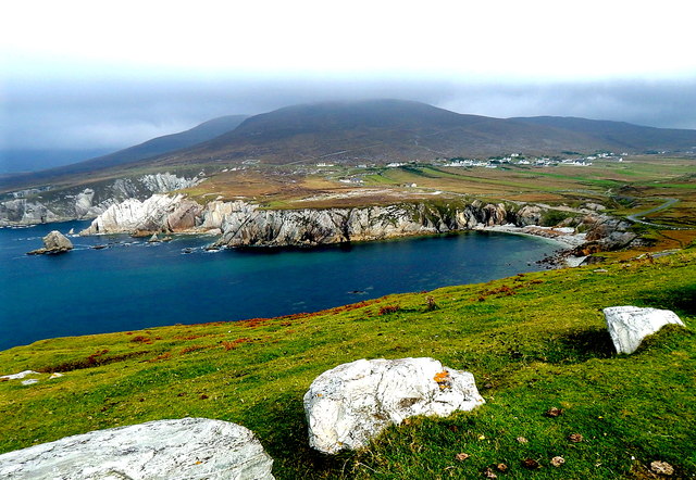
County Mayo - Achill Island - Portnahally / Ashliem Bay Viewpoint
Location is southeast of Dooega. View is to the northeast from a viewpoint just west of Atlantic Drive at its crest and at a right turn in the road where it steeply descends the hill along Portnahally / Ashliem Bay.
![Creative Commons Licence [Some Rights Reserved]](https://s1.geograph.org.uk/img/somerights20.gif)
|
· Find out How to reuse this image ·
Share:
|
|||||
| Start a discussion on L6896 | Suggest an update to this image | Contact the contributor | |||
Loading map... (JavaScript required)
- Grid Square
- L6896, 32 images (more nearby
 )
)
- Photographer
- Suzanne Mischyshyn (find more nearby)
- Date Taken
- Thursday, 26 September, 2013 (more nearby)
- Submitted
- Wednesday, 28 May, 2014
- Geographical Context
- Primary Subject of Photo
- Subject Location
-
Irish:
 L 688 967 [100m precision]
WGS84: 53:54.2023N 9:59.7874W - Camera Location
-
Irish: L 686 961
- View Direction
- North-northeast (about 22 degrees)
Image classification(about):
Geograph (Third Visitor for L6896)
This page has been viewed about 27 times.
View this location:
KML (Google Earth) ·
Google Maps ·
Bing Maps ·
Geograph Coverage Map ·
More Links for this image
·
Bing Maps ·
Geograph Coverage Map ·
More Links for this image