M3811 : Derelict Structure along N67 just northeast of Dunguaire Castle
taken 11 years ago, near to Kinvarra, Co Galway, Ireland
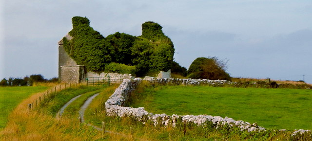
Derelict Structure along N67 just northeast of Dunguaire Castle
View is to the northwest from N67. It appears that this is a large farm structure, perhaps a stone barn of some sort.
![Creative Commons Licence [Some Rights Reserved]](https://s1.geograph.org.uk/img/somerights20.gif)
|
· Find out How to reuse this image ·
Share:
|
|||||
| Start a discussion on M3811 | Suggest an update to this image | Contact the contributor | |||
Loading map... (JavaScript required)
- Grid Square
- M3811, 7 images (more nearby
 )
)
- Photographer
- Suzanne Mischyshyn (find more nearby)
- Date Taken
- Friday, 27 September, 2013 (more nearby)
- Submitted
- Monday, 2 June, 2014
- Geographical Context
- Primary Subject of Photo
- Subject Location
-
Irish:
 M 383 110 [100m precision]
WGS84: 53:8.7844N 8:55.3441W - Camera Location
-
Irish: M 385 109
- View Direction
- West-northwest (about 292 degrees)
Image classification(about):
Supplemental image
This page has been viewed about 51 times.
View this location:
KML (Google Earth) ·
Google Maps ·
Bing Maps ·
Geograph Coverage Map ·
More Links for this image
·
Bing Maps ·
Geograph Coverage Map ·
More Links for this image