2007
SH4168 : Nr Malltraeth - Looking across the cob ponds from the embankment
taken 17 years ago, near to Malltraeth, Isle of Anglesey/Sir Ynys Mon, Wales
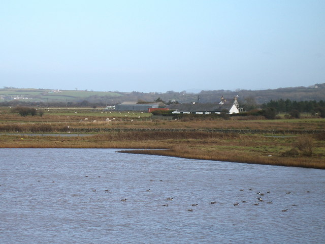
Nr Malltraeth - Looking across the cob ponds from the embankment
The Cob Ponds are a natural haven for wildlife. They were formed as a result of the flood controls and reclamation of land on the Cefni Estuary. There are farm buildings in the background.
 Map © Crown Copyright")
TIP: Click the map for more Large scale mapping
- Grid Square
- SH4168, 22 images (more nearby 🔍)
- Photographer
- Brian Charlton (more nearby)
- Date Taken
- Tuesday, 13 February, 2007 (more nearby)
- Submitted
- Sunday, 15 April, 2007
- Subject Location
-
OSGB36:
 SH 410 684 [100m precision]
WGS84: 53:11.3435N 4:22.8102W - Camera Location
-
OSGB36: SH 408 683
- View Direction
- EAST (about 90 degrees)