2014
NT9202 : Abandoned farmstead
taken 10 years ago, near to Harbottle, Northumberland, England
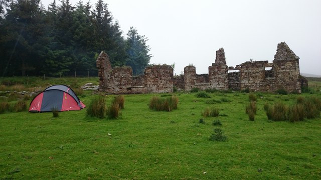
Abandoned farmstead
Abandoned disused Farmstead on Harbottle Crag. Falling quite badly into proper ruin, it won't be long till the centre wall falls.
 Map © Crown Copyright")
TIP: Click the map for more Large scale mapping
- Grid Square
- NT9202, 35 images (more nearby 🔍)
- Photographer
- Alan Pollock (more nearby)
- Date Taken
- Saturday, 7 June, 2014 (more nearby)
- Submitted
- Friday, 13 June, 2014
- Subject Location
-
OSGB36:
 NT 92271 02705 [1m precision]
WGS84: 55:19.1014N 2:7.4001W - Camera Location
-
OSGB36: NT 92272 02685
- View Direction
- NORTH (about 0 degrees)