2014
SK2794 : Marker stone above More Hall
taken 10 years ago, near to High Bradfield, Sheffield, England
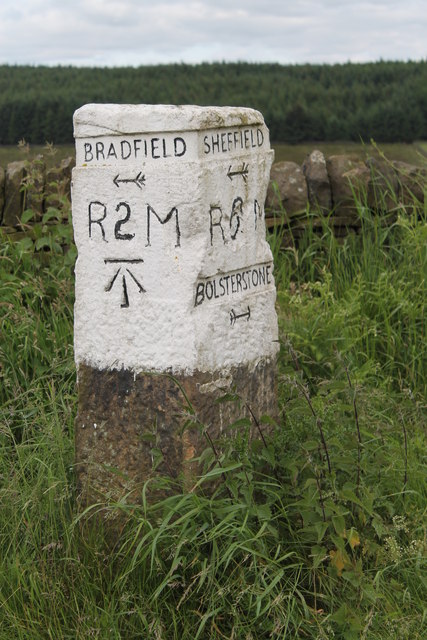
Marker stone above More Hall
A marker stone above More Hall indicates the routes to Bolsterstone, Bradfield and Sheffield.
 Map © Crown Copyright")
TIP: Click the map for more Large scale mapping
- Grid Square
- SK2794, 49 images (more nearby 🔍)
- Photographer
- Dave Pickersgill (more nearby)
- Date Taken
- Monday, 16 June, 2014 (more nearby)
- Submitted
- Monday, 16 June, 2014
- Subject Location
-
OSGB36:
 SK 2722 9426 [10m precision]
WGS84: 53:26.6647N 1:35.4994W - Camera Location
-
OSGB36: SK 2725 9427
- View Direction
- West-southwest (about 247 degrees)