2007
TQ9341 : Frid Farm
taken 17 years ago, near to Bethersden, Kent, England
This is 1 of 2 images, with title Frid Farm in this square
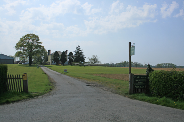
Frid Farm
Boasts its own aeroplane and landing strip
 Map © Crown Copyright")
TIP: Click the map for more Large scale mapping
- Grid Square
- TQ9341, 52 images (more nearby 🔍)
- Photographer
- Geoff Gartside (more nearby)
- Date Taken
- Sunday, 15 April, 2007 (more nearby)
- Submitted
- Monday, 16 April, 2007
- Subject Location
-
OSGB36:
 TQ 931 414 [100m precision]
WGS84: 51:8.4007N 0:45.5563E - Camera Location
-
OSGB36: TQ 932 415
- View Direction
- West-southwest (about 247 degrees)