2014
NN5727 : "The Cairn" on Meall Buidhe with Loch Tay beyond
taken 10 years ago, 4 km NNW of Lochearnhead, Stirling, Scotland
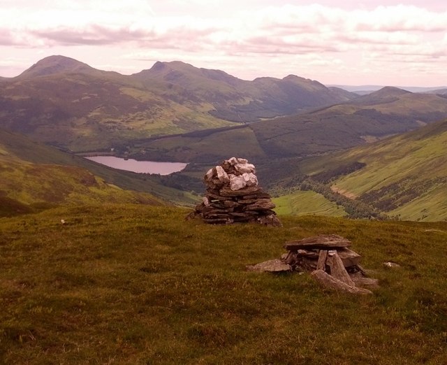
"The Cairn" on Meall Buidhe with Loch Tay beyond
The top is 10m to North. Loch Tay on left, disused railway line with trees/scrub is the line to the right
 Map © Crown Copyright")
TIP: Click the map for more Large scale mapping
- Grid Square
- NN5727, 12 images (more nearby 🔍)
- Photographer
- Phillip Williams (more nearby)
- Date Taken
- Thursday, 19 June, 2014 (more nearby)
- Submitted
- Thursday, 19 June, 2014
- Subject Location
-
OSGB36:
 NN 5765 2754 [10m precision]
WGS84: 56:25.1130N 4:18.5520W - Camera Location
-
OSGB36: NN 5763 2764
- View Direction
- SOUTH (about 180 degrees)