2005
SJ5787 : Sankey St.Helens Canal
taken 19 years ago, near to Great Sankey, Warrington, England
This is 1 of 2 images, with title Sankey St.Helens Canal in this square
Sankey St.Helens Canal
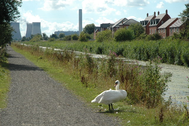
This is a view looking WSW down the Sankey St.Helens Canal. This canal used to be busy with fishermen throughout the year but are no longer allowed to fish here due to an unstable canal wall. The canal is now becoming over run with weed and algae. The Trans Pennine Trail runs along here and Fiddlers Ferry Power Station can be seen in the distance.
 Map © Crown Copyright")
TIP: Click the map for more Large scale mapping
- Grid Square
- SJ5787, 22 images (more nearby 🔍)
- Photographer
- andy (more nearby)
- Date Taken
- Saturday, 20 August, 2005 (more nearby)
- Submitted
- Saturday, 20 August, 2005
- Subject Location
-
OSGB36:
 SJ 577 874 [100m precision]
WGS84: 53:22.9046N 2:38.2426W