H2344 : Victorian Postbox, Enniskillen
taken 10 years ago, near to Enniskillen, Co Fermanagh, Northern Ireland
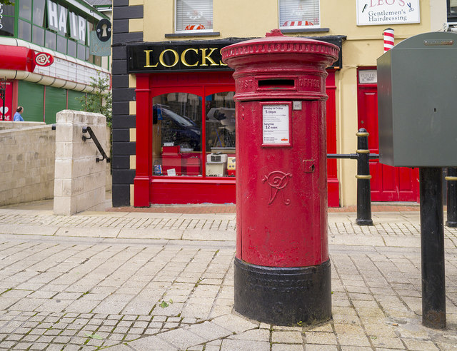
In the British Isles the first pillar post boxes were erected in Jersey in 1852. Roadside wall boxes first appeared in 1857 as a cheaper alternative to pillar boxes, especially in rural districts. In 1853 the first pillar box in Britain was installed at Botchergate, Carlisle. In 1856 Richard Redgrave of the Department of Science and Art designed an ornate pillar box for use in London and other large cities. In 1859 the design was improved, and this became the first National Standard pillar box. Green was adopted as the standard colour for the early Victorian post boxes. Between 1866 and 1879 the hexagonal Penfold post box became the standard design for pillar boxes and it was during this period that red was first adopted as the standard colour. The first boxes to be painted red were in London in July 1874, although it would be nearly 10 years before all the boxes had been repainted.
A series of photographs showing some of the postboxes, in the rest of Northern Ireland, within postcodes BT16-94. Link
shows the postboxes within Belfast.
A feature of Ulster towns and villages on both sides of the border. It was English and Scottish settlers who laid out the towns with a "diamond" at their centre.
![Creative Commons Licence [Some Rights Reserved]](https://s1.geograph.org.uk/img/somerights20.gif)
|
· Find out How to reuse this image ·
Share:
|
|||||
| Start a discussion on H2344 | Suggest an update to this image | Contact the contributor | |||
- Grid Square
- H2344, 589 images (more nearby
 )
)
- Photographer
- Rossographer (find more nearby)
- Date Taken
- Saturday, 9 August, 2014 (more nearby)
- Submitted
- Tuesday, 12 August, 2014
- Geographical Context
- Place (from Tags)
- Postbox (from Tags)
- Subject Location
-
Irish:
 H 235 440 [100m precision]
WGS84: 54:20.6884N 7:38.3456W - Camera Location
-
Irish: H 235 440
- View Direction
- Southwest (about 225 degrees)
Other Tags