2014
NR7736 : Forest track, Torr a' Ghobhainn, Kintyre
taken 10 years ago, near to Bridgend, Argyll And Bute, Scotland
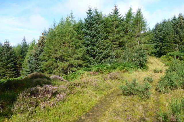
Forest track, Torr a' Ghobhainn, Kintyre
Forest road in the process of reverting to nature, no evidence of recent vehicle tracks. It may not stay this peaceful for long, there were sounds of active logging operations nearby. The slope to the left, (South West) drains into the Lephincorrach Burn in NR7735.
 Map © Crown Copyright")
TIP: Click the map for more Large scale mapping
- Grid Square
- NR7736, 2 images (more nearby 🔍)
- Photographer
- David G Campbell (more nearby)
- Date Taken
- Thursday, 14 August, 2014 (more nearby)
- Submitted
- Friday, 15 August, 2014
- Subject Location
-
OSGB36:
 NR 7786 3614 [10m precision]
WGS84: 55:34.0891N 5:31.4910W - Camera Location
-
OSGB36: NR 77917 36088
- View Direction
- Northwest (about 315 degrees)