D0444 : Ballintoy Village
taken 18 years ago, near to Ballintoy, Co Antrim, Northern Ireland
This is 1 of 2 images, with title Ballintoy Village in this square
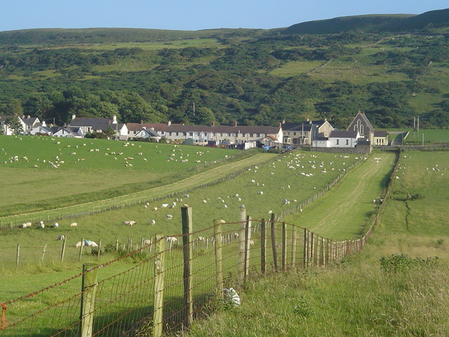
Ballintoy Village
View of Ballintoy from the north, showing the remains of the ancient strip field system.
![Creative Commons Licence [Some Rights Reserved]](https://s1.geograph.org.uk/img/somerights20.gif)
|
· Find out How to reuse this image ·
Share:
|
|||||
| Start a discussion on D0444 | Suggest an update to this image | Contact the contributor | |||
Loading map... (JavaScript required)
- Grid Square
- D0444, 156 images (more nearby
 )
)
- Photographer
- david speers (find more nearby)
- Date Taken
- Wednesday, 12 July, 2006 (more nearby)
- Submitted
- Wednesday, 25 April, 2007
- Category
- Ancient site > Ancient site (more nearby)
- Subject Location
-
Irish:
 D 045 445 [100m precision]
WGS84: 55:14.1865N 6:21.4859W - Camera Location
-
Irish: D 045 445
- View Direction
- SOUTH (about 180 degrees)
Image classification(about):
Geograph (Second Visitor for D0444)
This page has been viewed about 123 times.
View this location:
KML (Google Earth) ·
Google Maps ·
Bing Maps ·
Geograph Coverage Map ·
More Links for this image
·
Bing Maps ·
Geograph Coverage Map ·
More Links for this image