1971
TL1714 : Wheathampstead railway station (disused)
taken 53 years ago, near to Wheathampstead, Hertfordshire, England
This is 1 of 9 images, with title Wheathampstead railway station (disused) in this square
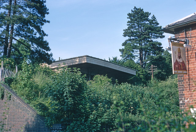
Wheathampstead railway station (disused)
Viewed through the gap between The Abbot John public house and the retaining wall of the railway bridge over the B651. The bridge had been removed by the time of the photograph. The Abbot John has since been demolished.
 Map © Crown Copyright")
TIP: Click the map for more Large scale mapping
- Grid Square
- TL1714, 108 images (more nearby 🔍)
- Photographer
- Jeremy Withrington (more nearby)
- Date Taken
- July 1971 (more nearby)
- Submitted
- Wednesday, 27 August, 2014
- Subject Location
-
OSGB36:
 TL 1783 1434 [10m precision]
WGS84: 51:48.9167N 0:17.5228W - Camera Location
-
OSGB36: TL 1774 1429
- View Direction
- East-northeast (about 67 degrees)