1971
TL1714 : Wheathampstead railway station (disused)
taken 53 years ago, near to Wheathampstead, Hertfordshire, England
This is 1 of 9 images, with title Wheathampstead railway station (disused) in this square
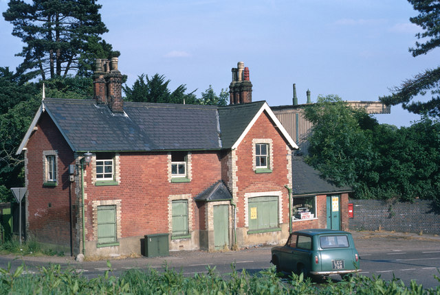
Wheathampstead railway station (disused)
The house on the corner between the B651 and Codicote Road viewed from the north side of the Lower Luton Road. The single-storey extension to the right was being used for selling coal. The station can be seen behind the house.
Since this photograph, the house and everything in the foreground has been removed to make way for a large roundabout.
Since this photograph, the house and everything in the foreground has been removed to make way for a large roundabout.
 Map © Crown Copyright")
TIP: Click the map for more Large scale mapping
- Grid Square
- TL1714, 108 images (more nearby 🔍)
- Photographer
- Jeremy Withrington (more nearby)
- Date Taken
- July 1971 (more nearby)
- Submitted
- Wednesday, 27 August, 2014
- Subject Location
-
OSGB36:
 TL 1783 1434 [10m precision]
WGS84: 51:48.9167N 0:17.5228W - Camera Location
-
OSGB36: TL 1774 1440
- View Direction
- East-southeast (about 112 degrees)