2014
NR4279 : Rubh' a' Mhail lighthouse with the Paps of Jura
taken 10 years ago, near to Rhuvaal [other Features], Argyll And Bute, Great Britain
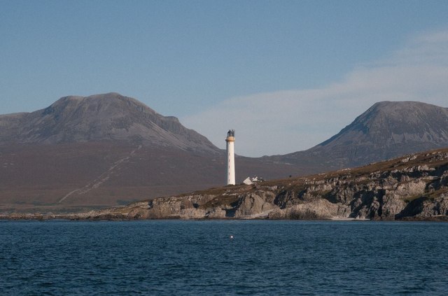
Rubh' a' Mhail lighthouse with the Paps of Jura
Seen from a boat. This is a Stevenson lighthouse, constructed between 1857 and 1859 by David and Thomas Stevenson.
 Map © Crown Copyright")
TIP: Click the map for more Large scale mapping
- Grid Square
- NR4279, 27 images (more nearby 🔍)
- Photographer
- Becky Williamson (more nearby)
- Date Taken
- Thursday, 4 September, 2014 (more nearby)
- Submitted
- Thursday, 4 September, 2014
- Subject Location
-
OSGB36:
 NR 4253 7917 [10m precision]
WGS84: 55:56.1849N 6:7.4561W - Camera Location
-
OSGB36: NR 41680 79683
- View Direction
- East-southeast (about 112 degrees)