2014
TF8938 : New solar farm at Egmere
taken 10 years ago, 3 km from Waterden, Norfolk, England
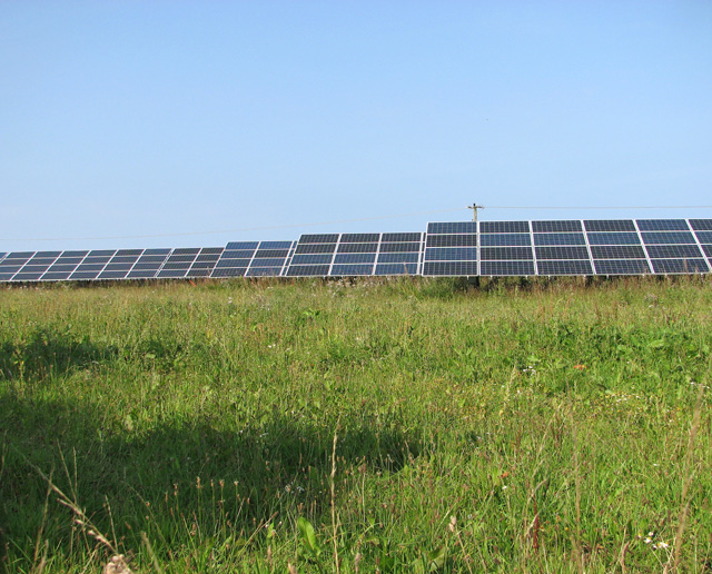
New solar farm at Egmere
This recently constructed solar farm is described as being the largest on-shore renewable energy project in North Norfolk. Located on the disused flying field of the former RAF North Creake, it will consist of approximately 82,280 panels distributed across an area measuring 48 hectares. The solar farm is one of three major renewable energy projects planned for Egmere; plans for an anaerobic digester > Link have already been approved.
 Map © Crown Copyright")
TIP: Click the map for more Large scale mapping
- Grid Square
- TF8938, 21 images (more nearby 🔍)
- Photographer
- Evelyn Simak (more nearby)
- Date Taken
- Wednesday, 10 September, 2014 (more nearby)
- Submitted
- Thursday, 11 September, 2014
- Subject Location
-
OSGB36:
 TF 8966 3852 [10m precision]
WGS84: 52:54.6374N 0:49.1431E - Camera Location
-
OSGB36: TF 8959 3844
- View Direction
- Northeast (about 45 degrees)