2014
NB4843 : Peat cutting
taken 10 years ago, near to Gress, Isle of Lewis And Harris, Na h-Eileanan an Iar, Scotland
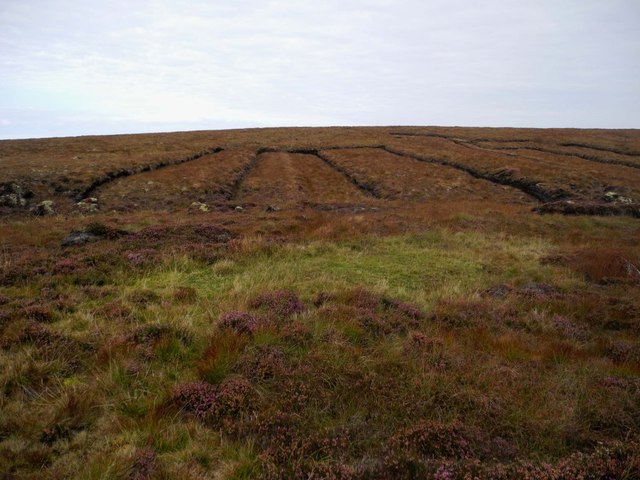
Peat cutting
These are fields where peat was cut. The top soil was carefully put back on again and the missing peat underneath shows as lower level.
 Map © Crown Copyright")
TIP: Click the map for more Large scale mapping
- Grid Square
- NB4843, 2 images (more nearby 🔍)
- Photographer
- Ingeborg Lechner and Robert Vucsina (more nearby)
- Date Taken
- Wednesday, 17 September, 2014 (more nearby)
- Submitted
- Thursday, 18 September, 2014
- Subject Location
-
OSGB36:
 NB 4830 4314 [10m precision]
WGS84: 58:18.2680N 6:17.8867W - Camera Location
-
OSGB36: NB 4831 4311
- View Direction
- North-northwest (about 337 degrees)