2007
TL5371 : Shelter near Pumphouse
taken 17 years ago, near to Upware, Cambridgeshire, England
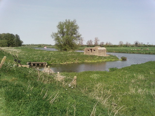
Shelter near Pumphouse
Shelter near the pumphouse on river Cam
 Map © Crown Copyright")
TIP: Click the map for more Large scale mapping
- Grid Square
- TL5371, 25 images (more nearby 🔍)
- Photographer
- Oda Stoevesandt and Karsten Koehler (more nearby)
- Date Taken
- Saturday, 28 April, 2007 (more nearby)
- Submitted
- Monday, 30 April, 2007
- Subject Location
-
OSGB36:
 TL 537 714 [100m precision]
WGS84: 52:19.1823N 0:15.2795E - Camera Location
-
OSGB36: TL 537 714
- View Direction
- East-northeast (about 67 degrees)