2007
NJ1028 : Wester Rynaballoch
taken 17 years ago, 3 km from Cromdale, Highland, Scotland
This is 1 of 2 images, with title Wester Rynaballoch in this square
Wester Rynaballoch
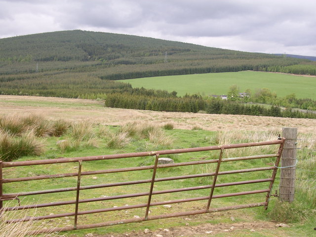
The house on the right is Wester Rynaballoch and the gate is where the path meets the track on the OS map. The hill in the background is Tom an Uird.
 Map © Crown Copyright")
TIP: Click the map for more Large scale mapping
- Grid Square
- NJ1028, 5 images (more nearby 🔍)
- Photographer
- Thelma Smart (more nearby)
- Date Taken
- Saturday, 12 May, 2007 (more nearby)
- Submitted
- Sunday, 13 May, 2007
- Subject Location
-
OSGB36:
 NJ 106 287 [100m precision]
WGS84: 57:20.4335N 3:29.1953W - Camera Location
-
OSGB36: NJ 109 283
- View Direction
- North-northwest (about 337 degrees)