2011
SM8840 : Llwybr Arfordir Sir Benfro / Pembrokeshire Coast Path
taken 13 years ago, near to Tresinwen, Pembrokeshire/Sir Benfro, Wales
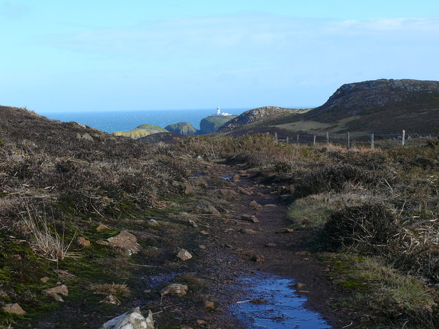
Llwybr Arfordir Sir Benfro / Pembrokeshire Coast Path
Goleudy Pen Caer yn y pellter / Strumble Head Lighthouse in the distance.
 Map © Crown Copyright")
TIP: Click the map for more Large scale mapping
- Grid Square
- SM8840, 28 images (more nearby 🔍)
- Photographer
- Ian Medcalf (more nearby)
- Date Taken
- Sunday, 27 February, 2011 (more nearby)
- Submitted
- Thursday, 29 January, 2015
- Subject Location
-
OSGB36:
 SM 8850 4019 [10m precision]
WGS84: 52:1.1827N 5:5.0313W - Camera Location
-
OSGB36: SM 8842 4012
- View Direction
- Northeast (about 45 degrees)