J1021 : The Middlebank embankment separating the Newry Canal from the Newry River
taken 9 years ago, 3 km from Burren, Co Down, Northern Ireland
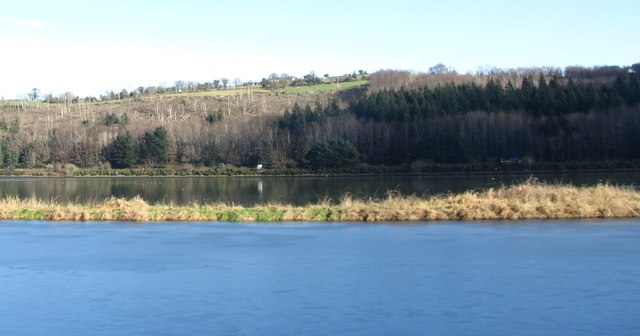
The Middlebank embankment separating the Newry Canal from the Newry River
Here the Middlebank appears very fragile.
The Newry Canal Middlebank
The embankment separating the Newry Ship Canal and the River Newry is known as the Middlebank. At present it is closed to the public for much its length. There are plans however to use the Middlebank as a link between the 20 mile Newry Canal Walk from Portadown to Newry and the Omeath - Carlingford Greenway. This would provide a motor vehicle free walking and cycling corridor from Portadown to Carlingford.
![Creative Commons Licence [Some Rights Reserved]](https://s1.geograph.org.uk/img/somerights20.gif)
|
· Find out How to reuse this image ·
Share:
|
|||||
| Start a discussion on J1021 | Suggest an update to this image | Contact the contributor | |||
Loading map... (JavaScript required)
- Grid Square
- J1021, 40 images (more nearby
 )
)
- Photographer
- Eric Jones (find more nearby)
- Date Taken
- Wednesday, 4 February, 2015 (more nearby)
- Submitted
- Wednesday, 11 February, 2015
- Geographical Context
- Subject Location
-
Irish:
 J 107 210 [100m precision]
WGS84: 54:7.5875N 6:18.4389W - Camera Location
-
Irish: J 106 210
- View Direction
- EAST (about 90 degrees)
Image classification(about):
Geograph
This page has been viewed about 25 times.
View this location:
KML (Google Earth) ·
Google Maps ·
Bing Maps ·
Geograph Coverage Map ·
More Links for this image
·
Bing Maps ·
Geograph Coverage Map ·
More Links for this image