D2817 : The Harbour Road, Carnlough
taken 17 years ago, near to Carnlough, Co Antrim, Northern Ireland
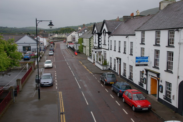
The Harbour Road, Carnlough
The Harbour Road is part of the coast road through Carnlough and is the villages main street. This is the view towards Larne and Belfast from the old railway bridge D2818 : Old railway bridge, Carnlough (2). The Londonderry Arms D2817 : The Londonderry Arms Carnlough is on the right.
![Creative Commons Licence [Some Rights Reserved]](https://s1.geograph.org.uk/img/somerights20.gif)
|
· Find out How to reuse this image ·
Share:
|
|||||
| Start a discussion on D2817 | Suggest an update to this image | Contact the contributor | |||
Loading map... (JavaScript required)
- Grid Square
- D2817, 81 images (more nearby
 )
)
- Photographer
- Albert Bridge (find more nearby)
- Date Taken
- Monday, 14 May, 2007 (more nearby)
- Submitted
- Wednesday, 16 May, 2007
- Category
- Street (more nearby)
- Subject Location
-
Irish:
 D 286 179 [100m precision]
WGS84: 54:59.5494N 5:59.4055W - Camera Location
-
Irish: D 287 179
- View Direction
- South-southwest (about 202 degrees)
This page has been viewed about 115 times.
View this location:
KML (Google Earth) ·
Google Maps ·
Bing Maps ·
Geograph Coverage Map ·
More Links for this image
·
Bing Maps ·
Geograph Coverage Map ·
More Links for this image