2007
TL0299 : Oilseed rape field from Easton Hornstocks
taken 17 years ago, 3 km from King's Cliffe, North Northamptonshire, England
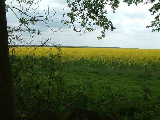
Oilseed rape field from Easton Hornstocks
Taken from the edge of Easton Hornstocks National Nature Reserve, looking towards Bedford Purlieus National Nature Reserve in the distance, across a field of oilseed rape.
 Map © Crown Copyright")
TIP: Click the map for more Large scale mapping
- Grid Square
- TL0299, 2 images (more nearby 🔍)
- Photographer
- Chris Gardiner (more nearby)
- Date Taken
- Friday, 27 April, 2007 (more nearby)
- Submitted
- Thursday, 17 May, 2007
- Subject Location
-
OSGB36:
 TL 022 998 [100m precision]
WGS84: 52:35.2000N 0:29.5229W - Camera Location
-
OSGB36: TF 020 000
- View Direction
- Southeast (about 135 degrees)