2014
TQ1937 : Sussex Border Path crosses Higham Gill, Horsegills Wood
taken 9 years ago, near to Rusper, West Sussex, England
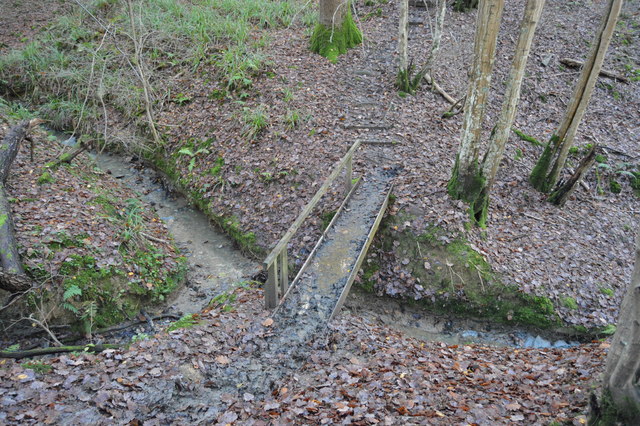
Sussex Border Path crosses Higham Gill, Horsegills Wood
Highams Gill
Highams Gill is a short (3Km) headwater tributary of the River Arun. It rises just west of Rusper.
Horsegills Wood
Horsegills Wood is a mixed deciduous woodland west of Rusper. There are some conifers at its eastern end. The Sussex Border path runs through it.
Sussex Border Path
The Sussex Border Path is a footpath route nearly 150 miles long around the inland boundary of the county of Sussex. The county owes its origins to the kingdom of the South Saxons and can claim to have one of the longest inland county boundaries from Emsworth to Rye. The route was devised in 1983 and is well signed along most of the route. Website Link

Map: Link
 Map © Crown Copyright")
TIP: Click the map for more Large scale mapping
- Grid Square
- TQ1937, 57 images (more nearby 🔍)
- Photographer
- N Chadwick (more nearby)
- Date Taken
- Sunday, 30 November, 2014 (more nearby)
- Submitted
- Thursday, 12 March, 2015
- Subject Location
-
OSGB36:
 TQ 1961 3731 [10m precision]
WGS84: 51:7.3558N 0:17.5370W - Camera Location
-
OSGB36: TQ 1961 3732
- View Direction
- East-southeast (about 112 degrees)