J3474 : New Lagan weir footbridge, Belfast - April 2015(5)
taken 9 years ago, near to Belfast, Co Antrim, Northern Ireland
The Department for Social Development (DSD) published a Draft Masterplan, in mid-December 2011, showing proposals for the redevelopment of Queens Quay and part of the surrounding area. The proposals envisage changing the area dramatically. They include provision for residential, recreational and tourist use. At present (January 2012) it forms an undeveloped space between Donegall Quay/The Obel Tower and the Titanic Quarter. Queens Quay was previously the quay where coal was imported and scrap metal exported for recycling.
The final version of the Masterplan for the redevelopment of the Queens Quay area was published on 29 August 2013 Link. It includes the proposed removal of the Station Street/Bridge End flyover.
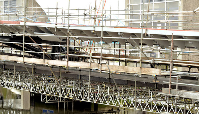
The first stage of the redevelopment is the replacement of the footbridge across the weir. The application for planning permission (December 2013) reads Z/2013/1369/F Donegal [sic] Quay Belfast Replacement of existing footbridge superstructure serving Lagan Weir, Belfast.
The photographs submitted by me appear as a matter of geographical and historical record only. I have no connection with the DSD and have no opinions about (for or against) the proposals.
They (or any scheme which might emerge from the consultation) are likely to take many years to complete.
![Creative Commons Licence [Some Rights Reserved]](https://s1.geograph.org.uk/img/somerights20.gif)
|
· Find out How to reuse this image ·
Share:
|
|||||
|
There are 4 posts in a
discussion on J3474 (preview on the left) |
Suggest an update to this image | Contact the contributor | |||
- Grid Square
- J3474, 4349 images (more nearby
 )
)
- Photographer
- Albert Bridge (find more nearby)
- Date Taken
- Sunday, 5 April, 2015 (more nearby)
- Submitted
- Sunday, 5 April, 2015
- Geographical Context
- Primary Subject of Photo
- Place (from Tags)
- Subject Location
-
Irish:
 J 344 745 [100m precision]
WGS84: 54:36.0724N 5:55.2540W - Camera Location
-
Irish: J 343 745
- View Direction
- East-southeast (about 112 degrees)
Other Tags