2007
ST2859 : Brean Down Trig Point
taken 17 years ago, 3 km from Brean, Somerset, England
This is 1 of 2 images, with title Brean Down Trig Point in this square
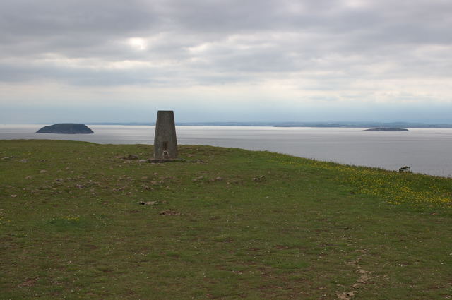
Brean Down Trig Point
Showing Steepholm & Flatholm in the distance.
 Map © Crown Copyright")
TIP: Click the map for more Large scale mapping
- Grid Square
- ST2859, 153 images (more nearby 🔍)
- Photographer
- Adrian Boliston (more nearby)
- Date Taken
- Saturday, 2 June, 2007 (more nearby)
- Submitted
- Saturday, 2 June, 2007
- Subject Location
-
OSGB36:
 ST 284 590 [100m precision]
WGS84: 51:19.5460N 3:1.6604W - Camera Location
-
OSGB36: ST 286 589
- View Direction
- West-northwest (about 292 degrees)