2015
SP1954 : Nineteenth-century benchmark in Ryland Street
taken 9 years ago, near to Stratford-Upon-Avon, Warwickshire, England
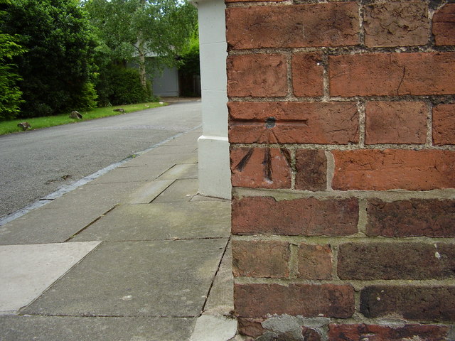
Nineteenth-century benchmark in Ryland Street
This benchmark on the side of 4 Trinity Street is shown on the 1884-9 map with a height of 126.2ft (Liverpool sea level Datum). The height given by the Ordnance Survey today is 38.330m (Newlyn sea level Datum). The house was built in 1837.
 Map © Crown Copyright")
TIP: Click the map for more Large scale mapping
- Grid Square
- SP1954, 331 images (more nearby 🔍)
- Photographer
- Shantavira (more nearby)
- Date Taken
- Thursday, 23 July, 2015 (more nearby)
- Submitted
- Friday, 24 July, 2015
- Subject Location
-
OSGB36:
 SP 1999 5424 [10m precision]
WGS84: 52:11.1629N 1:42.5416W - Camera Location
-
OSGB36: SP 1999 5424
- View Direction
- SOUTH (about 180 degrees)