2015
NB1000 : Sìdhean Beesdale
taken 9 years ago, 3 km from Ardhasaig, Isle of Lewis And Harris, Na h-Eileanan an Iar, Scotland
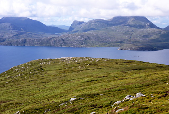
Sìdhean Beesdale
The northeasterly spur of Ben Luskentyre. Behind is West Loch Tarbet, and An Cliseam (disappearing into the cloud).
 Map © Crown Copyright")
TIP: Click the map for more Large scale mapping
- Grid Square
- NB1000 (more nearby 🔍)
- Photographer
- Toby Speight (more nearby)
- Date Taken
- Friday, 31 July, 2015 (more nearby)
- Submitted
- Tuesday, 4 August, 2015
- Subject Location
-
OSGB36:
 NB 1051 0075 [10m precision]
WGS84: 57:54.1127N 6:53.2984W - Camera Location
-
OSGB36: NB 10438 00273
- View Direction
- NORTH (about 0 degrees)