2015
SP2540 : Nineteenth-century benchmark on church
taken 9 years ago, near to Shipston-on-Stour, Warwickshire, England
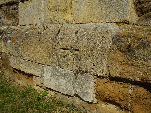
Nineteenth-century benchmark on church
This benchmark was established between 1850 and 1856 during the First primary levelling of England & Wales, and was levelled with a height of 212.2660 feet [64.6987 metres] above mean sea level (Liverpool datum). It was included on the Basingstoke to Coventry levelling line. The surveyor's description was "No. 165. Bolt in West side of tower of Shipston-on-Stour Church ; 1.82 ft. above surface" (Public Abstract p.239). It is behind the war memorial, facing the main road.
 Map © Crown Copyright")
TIP: Click the map for more Large scale mapping
- Grid Square
- SP2540, 186 images (more nearby 🔍)
- Photographer
- Shantavira (more nearby)
- Date Taken
- Saturday, 8 August, 2015 (more nearby)
- Submitted
- Sunday, 9 August, 2015
- Subject Location
-
OSGB36:
 SP 2590 4062 [10m precision]
WGS84: 52:3.8013N 1:37.4170W - Camera Location
-
OSGB36: SP 2590 4062
- View Direction
- East-northeast (about 67 degrees)