2015
SN7278 : Cwm Rheidol mine
taken 9 years ago, near to Ystumtuen, Ceredigion/Sir Ceredigion, Wales
This is 1 of 5 images, with title Cwm Rheidol mine in this square
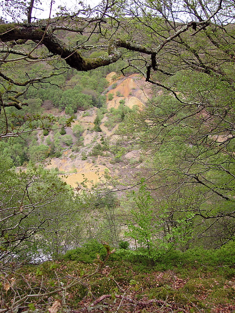
Cwm Rheidol mine
The remnants of the lead mine and the environmental damage it has left behind are seen here from across the Afon Rheidol. Mining began here in the 1840s to provide an alternative way of accessing the seams worked by Ystumtuen mine about a kilometre to the northeast. The topography of the Rheidol gorge made it possible to drive a (horizontal) adit rather than accessing the ore through vertical shafts from above. The pre-processed ore was transferred across the gorge via an aerial ropeway and then moved to Aberystwyth on what is now the Vale of Rheidol railway. The mine was operated, with interruptions, until 1917.
 Map © Crown Copyright")
TIP: Click the map for more Large scale mapping
- Grid Square
- SN7278, 286 images (more nearby 🔍)
- Photographer
- Rudi Winter (more nearby)
- Date Taken
- Monday, 4 May, 2015 (more nearby)
- Submitted
- Thursday, 13 August, 2015
- Subject Location
-
OSGB36:
 SN 7288 7839 [10m precision]
WGS84: 52:23.3240N 3:52.1625W - Camera Location
-
OSGB36: SN 7277 7807
- View Direction
- North-northeast (about 22 degrees)