2015
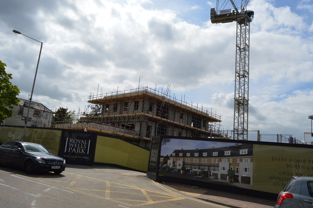
TQ5839 : Crane, Royal Wells Park
taken 9 years ago, near to Royal Tunbridge Wells, Kent, England
This is 1 of 2 images, with title Crane, Royal Wells Park in this square
Crane, Royal Wells Park
Formerly the Kent & Sussex Hospital.TQ5839 : Kent and Sussex Hospital.
Kent and Sussex Hospital (Former site)
The Kent and Sussex Hospital was a district general hospital located on Mount Ephraim in Tunbridge Wells serving the West Kent and East Sussex areas. It closed on 21 September 2011 and was replaced by The Tunbridge Wells Hospital in Pembury, nearly three miles from the town.
The hospital building was designed by Cecil Burns, a local architect, and opened in 1934. The foundation stone had been laid in 1932 by the Duchess of York, later to become Queen Elizabeth, the Queen Mother.
The site has been redeveloped as Royal Wells Park with houses, a school and business premises.
 Map © Crown Copyright")
TIP: Click the map for more Large scale mapping
- Grid Square
- TQ5839, 5499 images (more nearby 🔍)
- Photographer
- N Chadwick (more nearby)
- Date Taken
- Sunday, 17 May, 2015 (more nearby)
- Submitted
- Saturday, 5 September, 2015
- Subject Location
-
OSGB36:
 TQ 5823 3986 [10m precision]
WGS84: 51:8.1692N 0:15.6162E - Camera Location
-
OSGB36: TQ 5826 3986
- View Direction
- WEST (about 270 degrees)