2004
NO2218 : Looking down the Tay from west of Newburgh
taken 20 years ago, near to Newburgh, Fife, Scotland
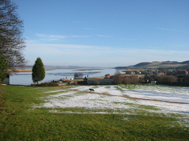
Looking down the Tay from west of Newburgh
Past Newburgh, Normans Law and Black Earnside on the south side of the estuary overlook the "Hard", "Little Bank" and "Peesweep" bank which have been exposed by the ebbing tide.
 Map © Crown Copyright")
TIP: Click the map for more Large scale mapping
- Grid Square
- NO2218, 33 images (more nearby 🔍)
- Photographer
- Bob Moncrieff (more nearby)
- Date Taken
- Monday, 9 February, 2004 (more nearby)
- Submitted
- Wednesday, 31 August, 2005
- Subject Location
-
OSGB36:
 NO 228 182 [100m precision]
WGS84: 56:20.9892N 3:15.0433W