2006
NZ0042 : Whitelee Toll Bar
taken 18 years ago, 3 km from Crawleyside, County Durham, England
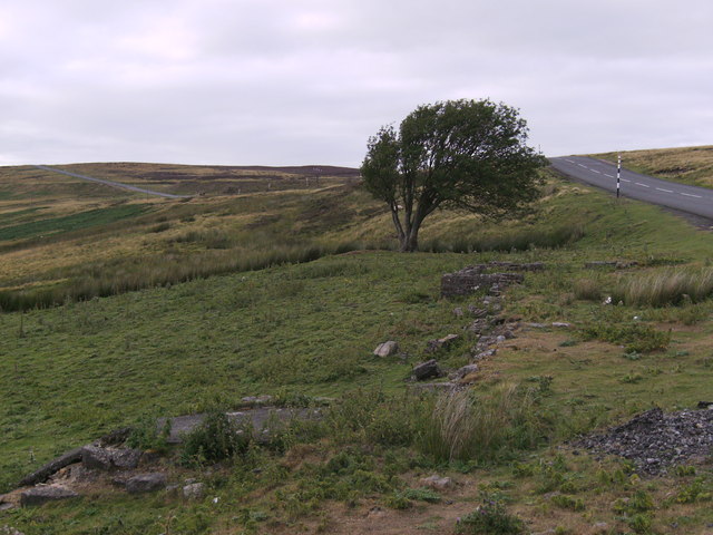
Whitelee Toll Bar
The foundations of the old toll house on the Shotley-Stanhope turnpike, now the B6278 north of Stanhope. This was kept by John and Dorothy Coulson for many decades. Certainly they were there by 1841 and raised a large family at this bleak spot, 425m AOD. John worked as "road master" for the toll road company and Dorothy as a toll collector. They must have been tough; Dorothy died in 1855 aged about 72 and John in 1866 aged about 83. At the age of 78 he was still listing his occupation as "turnpike road repairer".
 Map © Crown Copyright")
TIP: Click the map for more Large scale mapping
- Grid Square
- NZ0042, 46 images (more nearby 🔍)
- Photographer
- Jon Reeds (more nearby)
- Date Taken
- Saturday, 5 August, 2006 (more nearby)
- Submitted
- Friday, 9 October, 2015
- Subject Location
-
OSGB36:
 NZ 0002 4264 [10m precision]
WGS84: 54:46.7203N 2:0.0727W - Camera Location
-
OSGB36: NZ 0000 4261
- View Direction
- Northeast (about 45 degrees)