J3473 : Maysfields development site, Belfast - October 2015(3)
taken 8 years ago, near to Belfast, Co Antrim, Northern Ireland
This is 1 of 4 images, with title starting with Maysfields development site, Belfast - October in this square
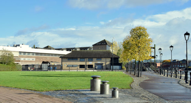
Maysfields development site, Belfast - October 2015(3)
The site, looking in the general direction of the Albert Bridge. The Lagan is on the right. J3473 : Allstate offices, Maysfields, Belfast (July 2018) shows the site after development.
The Allstate site, Maysfields,Belfast
A site, at Maysfields, close to Central station for which there is (8 December 2015) the following planning permission Z/2015/0182/F New office development (6 storey with roof plant) with realignment of existing car parking, infilling of slipways, refurbishment of marina steps, creation of new cycleway, new area of open space and associated landscaping. Lands adjacent to East Bridge Street and accessed off Laganbank Road located between former Maysfield Leisure Centre and Central Station Belfast BT1 3PB.
![Creative Commons Licence [Some Rights Reserved]](https://s1.geograph.org.uk/img/somerights20.gif)
|
· Find out How to reuse this image ·
Share:
|
|||||
| Start a discussion on J3473 | Suggest an update to this image | Contact the contributor | |||
Loading map... (JavaScript required)
- Grid Square
- J3473, 885 images (more nearby
 )
)
- Photographer
- Albert Bridge (find more nearby)
- Date Taken
- Saturday, 24 October, 2015 (more nearby)
- Submitted
- Saturday, 24 October, 2015
- Geographical Context
- Place (from Tags)
- Subject Location
-
Irish:
 J 347 737 [100m precision]
WGS84: 54:35.6364N 5:54.9791W - Camera Location
-
Irish: J 347 737
- View Direction
- Northeast (about 45 degrees)
Other Tags
Image classification(about):
Geograph
This page has been viewed about 125 times.
View this location:
KML (Google Earth) ·
Google Maps ·
Bing Maps ·
Geograph Coverage Map ·
More Links for this image
·
Bing Maps ·
Geograph Coverage Map ·
More Links for this image