2015
SN7886 : Summit cairn of Pen Pumlumon Fawr
taken 8 years ago, near to Plynlimon/Pumlumon Fawr [hill or Mountain], Ceredigion, Great Britain
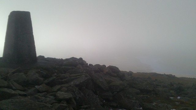
Summit cairn of Pen Pumlumon Fawr
The cloudbase touches the summit of Pumlumon. A sunny Nant-y-moch reservoir can be seen through the mist on the right, some 500m below.
 Map © Crown Copyright")
TIP: Click the map for more Large scale mapping
- Grid Square
- SN7886, 91 images (more nearby 🔍)
- Photographer
- Rudi Winter (more nearby)
- Date Taken
- Sunday, 22 November, 2015 (more nearby)
- Submitted
- Tuesday, 24 November, 2015
- Subject Location
-
OSGB36:
 SN 7896 8694 [10m precision]
WGS84: 52:28.0164N 3:46.9908W - Camera Location
-
OSGB36: SN 7898 8694
- View Direction
- West-northwest (about 292 degrees)