SE1437 : Shipley station, Leeds-Skipton line platforms
taken 16 years ago, near to Shipley, Bradford, England
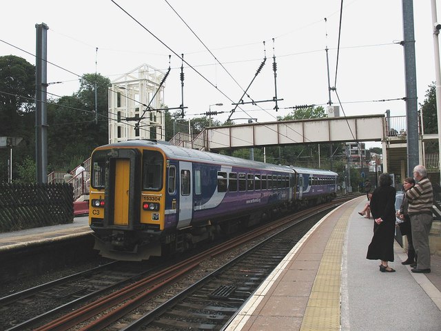
The lift shaft behind the train was at this time incomplete: the lifts opened in 2009 and the finished article can be seen at SE1437 : Shipley Station on Christmas Day.
The early history of this station is unclear. Sources (1) and (2) agree that the first Shipley Station was opened in 1846 by the Leeds and Bradford Railway. (1) places it adjacent to Valley Road bridge but (2) puts it, at least from 1849, on roughly its present site. The present triangular station was built by the Midland Railway - in 1875 according to source (1) and between 1883 and 1892 according to (2). For much of its life it only had platforms on two of its three sides (Bradford-Skipton and Bradford-Leeds lines). The platform on the westbound track of the Leeds-Skipton- Carlisle line was added in 1979, and the matching eastbound platform as late as 1992 as part of the electrification of the route. Both sources agree that it is one of only two remaining triangular stations in the UK, the other being Earlsfield.
Sources: (1) "West Yorkshire Railway Stations", Peter Tuffrey, 2011. (2) Wikipedia Link
 Map © Crown Copyright")
- Grid Square
- SE1437, 1065 images (more nearby 🔍)
- Photographer
- Stephen Craven (more nearby)
- Date Taken
- Sunday, 14 September, 2008 (more nearby)
- Submitted
- Saturday, 19 December, 2015
- Subject Location
-
OSGB36:
 SE 1496 3755 [10m precision]
WGS84: 53:50.0397N 1:46.4501W - Camera Location
-
OSGB36: SE 1499 3756
- View Direction
- West-southwest (about 247 degrees)