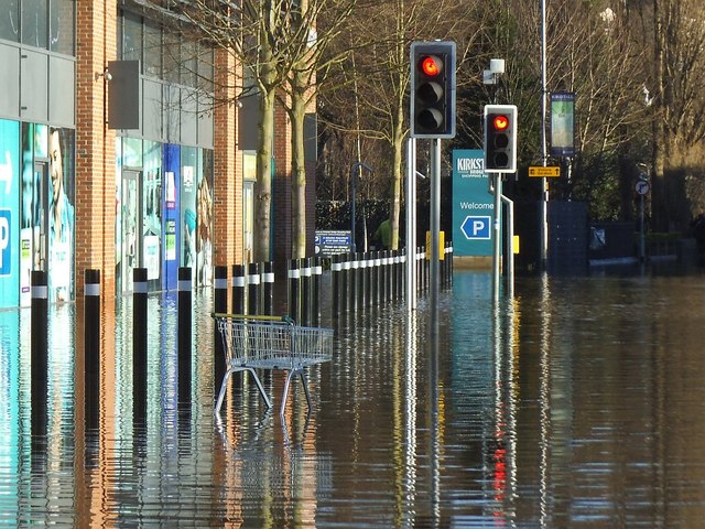
SE2635 : Trolley abandoned in the floods
taken 8 years ago, near to Headingley, Leeds, England
The River Aire caused severe flooding on Boxing Day, December 26th 2015. There had been very heavy rain during the night and morning, following on from previous heavy rain over 2 or 3 weeks. The saturated ground caused the river to rise rapidly and by mid afternoon the Aire was flooding the area around Newlay Bridge. There are a few houses by the bridge, one was already being bailed out, and horses were being evacuated from the stables on the other side of the river. 3 or 4 houses seemed to be at risk from flooding.
A friend went to the bridge the following day and found it had been closed until it could be examined for structural damage.
The flooding was more severe further downstream. The bridge at Kirsktall was closed from the evening, and Kirkstall Road (the A65) was flooded from the junction of Woodside Place (SE271347) to beyond Kirkstall Viaduct and the studios of Radio Aire (SE282341), a distance of about a mile. This was still under water for much of the following day.
 Map © Crown Copyright")
- Grid Square
- SE2635, 738 images (more nearby 🔍)
- Photographer
- Stephen Craven (more nearby)
- Date Taken
- Sunday, 27 December, 2015 (more nearby)
- Submitted
- Monday, 28 December, 2015
- Subject Location
-
OSGB36:
 SE 2612 3559 [10m precision]
WGS84: 53:48.9564N 1:36.2858W - Camera Location
-
OSGB36: SE 2611 3559
- View Direction
- East-northeast (about 67 degrees)