J3829 : Newcastle Harbour from the Drinneevar Ridge
taken 8 years ago, 3 km from Newcastle, Co Down, Northern Ireland
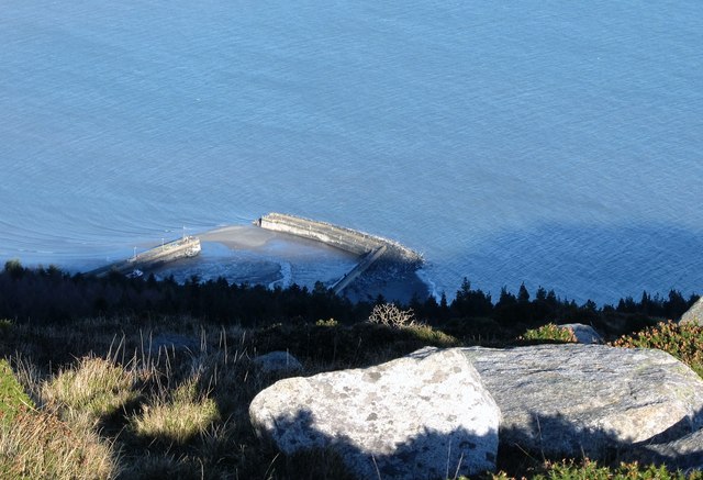
Newcastle Harbour from the Drinneevar Ridge
The harbour was constructed in the 1820s by Lord Annesley to export granite quarries on the hills above.
![Creative Commons Licence [Some Rights Reserved]](https://s1.geograph.org.uk/img/somerights20.gif)
|
· Find out How to reuse this image ·
Share:
|
|||||
| Start a discussion on J3829 | Suggest an update to this image | Contact the contributor | |||
Loading map... (JavaScript required)
- Grid Square
- J3829, 207 images (more nearby
 )
)
- Photographer
- Eric Jones (find more nearby)
- Date Taken
- Wednesday, 20 January, 2016 (more nearby)
- Submitted
- Friday, 22 January, 2016
- Geographical Context
- Subject Location
-
Irish:
 J 381 296 [100m precision]
WGS84: 54:11.8228N 5:53.0821W - Camera Location
-
Irish: J 379 287
- View Direction
- NORTH (about 0 degrees)
Image classification(about):
Supplemental image
This page has been viewed about 22 times.
View this location:
KML (Google Earth) ·
Google Maps ·
Bing Maps ·
Geograph Coverage Map ·
More Links for this image
·
Bing Maps ·
Geograph Coverage Map ·
More Links for this image