2016
NS3679 : Path through Carman Quarry
taken 8 years ago, near to Renton, West Dunbartonshire, Scotland
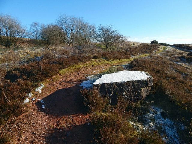
Path through Carman Quarry
This is the northern end of the former quarry. To the right of the path, with a light covering of snow, is a large red sandstone block. The path is marked on large-scale OS mapping, and leads to the top of Carman Hill.
The former Fairy Knowe Quarry :: NS3779
Red sandstone was quarried here. The site was formerly a small hill called Fairy Knowe, but it became a quarry at the end of the nineteenth century; later maps call it Carman Quarry. It has long been disused. See Link
for an annotated satellite view putting this site in its geological context. See Link and Link (in a Geograph article) for more on the quarry, the Fairy Knowe, and old traditions about this site and Havoc Hole.
 Map © Crown Copyright")
TIP: Click the map for more Large scale mapping
- Grid Square
- NS3679, 44 images (more nearby 🔍)
- Photographer
- Lairich Rig (more nearby)
- Date Taken
- Thursday, 14 January, 2016 (more nearby)
- Submitted
- Monday, 1 February, 2016
- Subject Location
-
OSGB36:
 NS 3692 7906 [10m precision]
WGS84: 55:58.6044N 4:36.9048W - Camera Location
-
OSGB36: NS 3691 7906
- View Direction
- EAST (about 90 degrees)