2016
SO8170 : Nineteenth century benchmark on Stour Bridge
taken 8 years ago, near to Stourport-on-Severn, Worcestershire, England
Nineteenth century benchmark on Stour Bridge
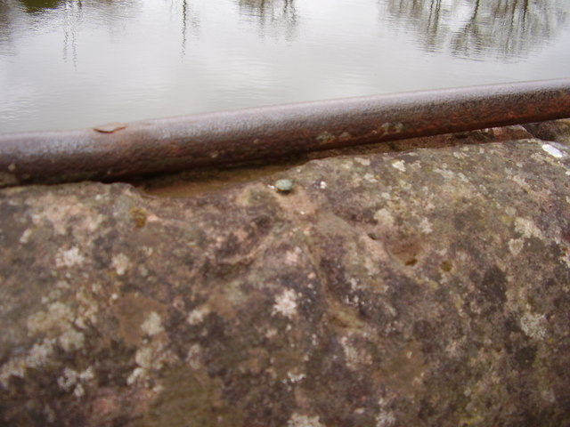
This benchmark was established during the First primary levelling of England & Wales, and was levelled with a height of 66.2260 feet [20.1857 metres] above mean sea level (Liverpool datum). It was included as a side level on the Worcester to Aberystwyth levelling line. The surveyor's description was "No. 32(c). Stour Bridge, over River Stour, at junction with the Severn. Mark on East face of West battlement ; 2.73 ft. above surface (Public Abstract p. 551). The rather worn mark can be found on the south-west parapet of the footbridge, 13m from the north-west buttress. The level is the top of the rivet.
 Map © Crown Copyright")
TIP: Click the map for more Large scale mapping
- Grid Square
- SO8170, 254 images (more nearby 🔍)
- Photographer
- Shantavira (more nearby)
- Date Taken
- Saturday, 19 March, 2016 (more nearby)
- Submitted
- Monday, 21 March, 2016
- Subject Location
-
OSGB36:
 SO 8127 7079 [10m precision]
WGS84: 52:20.0923N 2:16.5781W - Camera Location
-
OSGB36: SO 8127 7079
- View Direction
- Southwest (about 225 degrees)