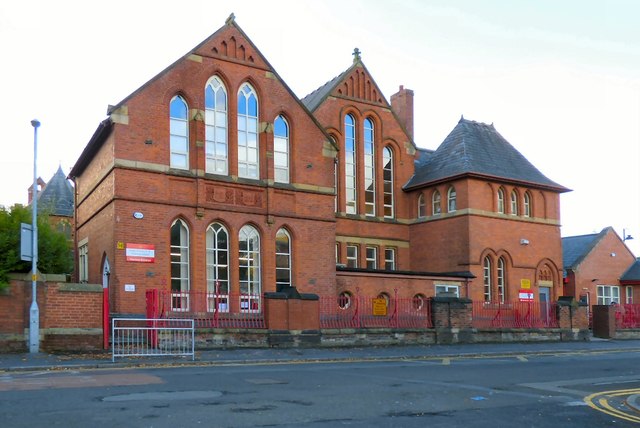
SJ9399 : Holy Trinity C of E Primary School
taken 9 years ago, near to Ashton-Under-Lyne, Tameside, England
School Website: Link
Holy Trinity Church, Ashton under Lyne was built in 1876. It is a brick building in the early English style and consisted of chancel with aisles, nave, transepts, north and south porches and a belfry containing three bells. There were over 700 seatings.
In the late 1980s, Holy Trinity Church was considered to be a big barn of a building, empty for most of the week, cold and used by only a handful of mainly elderly local people. The majority of the local population were Muslims, mainly from Pakistan and Bangladesh. The church building, still dominated the locality, but the activity in it was increasingly marginal to community life.
The building now consists of a worship space in the eastern half of the building. The community rooms occupy the western half on two floors and are managed by St Peter's Youth (SPY) who are part of St Peter's Partnership.
It is part of the Parish of the Good Shepherd. Link
 Map © Crown Copyright")
- Grid Square
- SJ9399, 598 images (more nearby 🔍)
- Photographer
- Gerald England (more nearby)
- Date Taken
- Friday, 25 September, 2015 (more nearby)
- Submitted
- Friday, 8 April, 2016
- Subject Location
-
OSGB36:
 SJ 9328 9918 [10m precision]
WGS84: 53:29.3572N 2:6.1649W - Camera Location
-
OSGB36: SJ 9331 9918
- View Direction
- West-northwest (about 292 degrees)