J4569 : Belfast and County Down Railway ground plaque, Comber (April 2016)
taken 8 years ago, near to Comber, Co Down, Northern Ireland
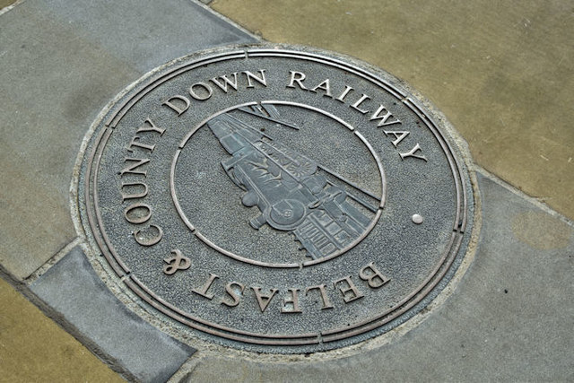
Belfast and County Down Railway ground plaque, Comber (April 2016)
One of several ground plaques incorporated into recent environmental improvements around The Square.
The Belfast and County Down Railway
The Belfast and County Down Railway ran from Queens Quay station in Belfast to Castlewellan via Comber, Downpatrick and Newcastle. There were also lines from Comber to Donaghadee via Newtownards, Belfast to Bangor and branches from Ballynahinch Jct to Ballynahinch and Downpatrick to Ardglass. The lines opened between 1848 and 1892. All closed by 1950 except for Castlewellan Newcastle which survived until 1955 as part of the GNR(I) route from Belfast via Banbridge and the Bangor line which remains open but from Belfast Central.
Blue and other plaques in Northern Ireland
A series of photographs of blue and other commemorative plaques in Northern Ireland. Many of the blue plaques were provided by the Ulster History Circle Link.
![Creative Commons Licence [Some Rights Reserved]](https://s1.geograph.org.uk/img/somerights20.gif)
|
· Find out How to reuse this image ·
Share:
|
|||||
| Start a discussion on J4569 | Suggest an update to this image | Contact the contributor | |||
Loading map... (JavaScript required)
- Grid Square
- J4569, 201 images (more nearby
 )
)
- Photographer
- Albert Bridge (find more nearby)
- Date Taken
- Tuesday, 19 April, 2016 (more nearby)
- Submitted
- Tuesday, 19 April, 2016
- Geographical Context
- Place (from Tags)
- Primary Subject of Photo
- Subject Location
-
Irish:
 J 459 691 [100m precision]
WGS84: 54:32.9992N 5:44.7080W - Camera Location
-
Irish: J 459 691
- View Direction
- South-southwest (about 202 degrees)
Other Tags
Image classification(about):
Supplemental image
This page has been viewed about 126 times.
View this location:
KML (Google Earth) ·
Google Maps ·
Bing Maps ·
Geograph Coverage Map ·
More Links for this image