2007
NN7569 : Crossing the Vein
taken 16 years ago, near to Dalinturuaine [other Features], Perth And Kinross, Great Britain
Crossing the Vein
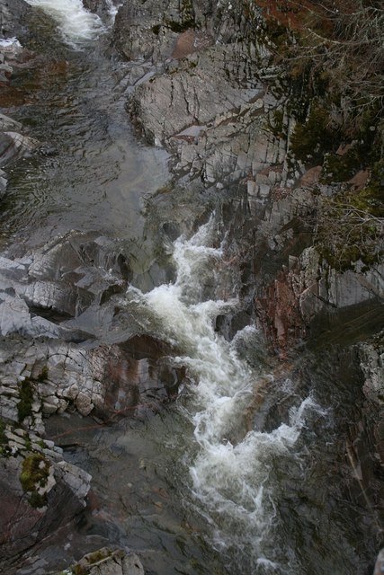
The Dalnamein Allt a' Chireachain outlet of the Allt Glas Choire illustrates the domination of the flow and fault crossing the intrusion metamorphic structures and the small vein within the system resulting in cascade falls twisted around the rock fragments and structures rather than following the most recent forms in the rock, as a material weathered or a rock mass structure formation, the drop to the Garry and the high regime flows of the upland and local fractures since the rock formation, control the stream; although engineering works before Wade, during General Wade and the recent bridge and then its replacement must have a severe effect on river stream backwater and flood spate force, during high stage, this being low stage.
 Map © Crown Copyright")
TIP: Click the map for more Large scale mapping
- Grid Square
- NN7569, 39 images (more nearby 🔍)
- Photographer
- Michael Dennis Stagg (more nearby)
- Date Taken
- Saturday, 8 December, 2007 (more nearby)
- Submitted
- Wednesday, 20 April, 2016
- Subject Location
-
OSGB36:
 NN 7544 6973 [10m precision]
WGS84: 56:48.1421N 4:2.4824W - Camera Location
-
OSGB36: NN 7547 6967
- View Direction
- North-northwest (about 337 degrees)