2016
NO2716 : View across Inchrye reedbeds to Glenduckie and Norman's Law
taken 8 years ago, near to Dunbog, Fife, Scotland
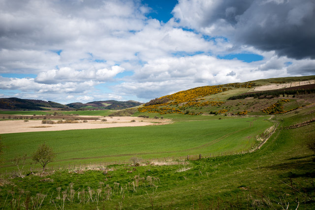
View across Inchrye reedbeds to Glenduckie and Norman's Law
Standing on the Dunbog to Lindores Loch track looking North East. The extensive reedbeds aren't named on the map but lie between Inchrye and Dunbog. On the Northern side is a dismantled railway that used to connect the Den of Lindores with Kilmany and then Wormit ... now long gone. In the distance is Norman's Law, the highest point in the North Fife Hills.
 Map © Crown Copyright")
TIP: Click the map for more Large scale mapping
- Grid Square
- NO2716, 17 images (more nearby 🔍)
- Photographer
- David (more nearby)
- Date Taken
- Saturday, 30 April, 2016 (more nearby)
- Submitted
- Saturday, 30 April, 2016
- Subject Location
-
OSGB36:
 NO 2796 1684 [10m precision]
WGS84: 56:20.3051N 3:10.0127W - Camera Location
-
OSGB36: NO 27652 16258
- View Direction
- North-northeast (about 22 degrees)