J5174 : Former Thriving Life church, Newtownards - June 2016(1)
taken 8 years ago, near to Newtownards, Co Down, Northern Ireland
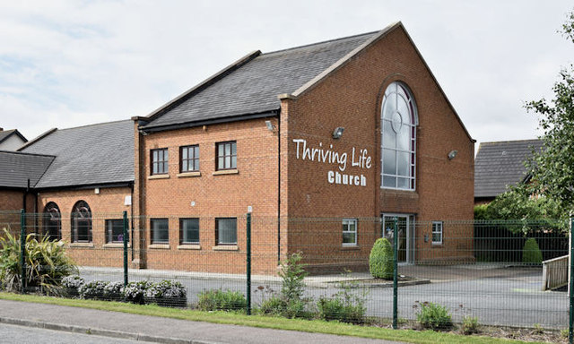
Currently (June 2016) vacant church and associated buildings at the corner of the Movilla and Ballyreagh Roads. Offered for sale and described by the agents as Due to the increasing membership Thriving Life Church is moving to larger premises. This happy state of affairs brings to the market these excellent church premises situated on the outskirts on the east of Newtownards. The site extends to about one acre and provides parking for about 80 cars. There is a grass area that could provide further parking, for up to another 30 cars. Total floor space 6,260 square feet (581.5 sq m) Suitable for alternative uses (subject to planning). The church building lies on white land while most of the parking and grass is zoned for housing.
The churchs website records What started in a living room, moved to a hotel, then to a local Scout Hall, then to Movilla Road and eventually to our new premises opened June 2015 on Crawfordsburn Road Newtownards.
The photographs submitted by me appear as a matter of record only. I have no connection with the church or the agents.
![Creative Commons Licence [Some Rights Reserved]](https://s1.geograph.org.uk/img/somerights20.gif)
|
· Find out How to reuse this image ·
Share:
|
|||||
| Start a discussion on J5174 | Suggest an update to this image | Contact the contributor | |||
- Grid Square
- J5174, 20 images (more nearby
 )
)
- Photographer
- Albert Bridge (find more nearby)
- Date Taken
- Wednesday, 22 June, 2016 (more nearby)
- Submitted
- Wednesday, 22 June, 2016
- Geographical Context
- Place (from Tags)
- Subject Location
-
Irish:
 J 513 743 [100m precision]
WGS84: 54:35.6938N 5:39.5453W - Camera Location
-
Irish: J 513 743
- View Direction
- Southwest (about 225 degrees)
Other Tags