2016
NC1623 : The upper reaches of the Allt an Tiaghaich
taken 8 years ago, 5 km E of Brackloch, Highland, Scotland
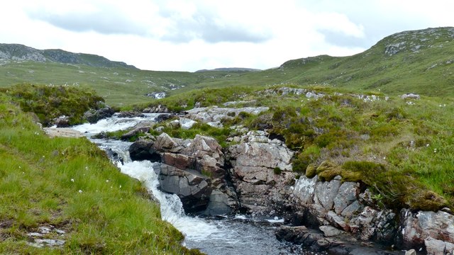
The upper reaches of the Allt an Tiaghaich
This is the view looking upstream to the waterfall at the exit of the Allt an Tiaghaich from Loch a'Ghlinnein.
 Map © Crown Copyright")
TIP: Click the map for more Large scale mapping
- Grid Square
- NC1623, 11 images (more nearby 🔍)
- Photographer
- AlastairG (more nearby)
- Date Taken
- Wednesday, 29 June, 2016 (more nearby)
- Submitted
- Friday, 1 July, 2016
- Subject Location
-
OSGB36:
 NC 165 233 [100m precision]
WGS84: 58:9.6275N 5:7.1685W - Camera Location
-
OSGB36: NC 165 233
- View Direction
- East-southeast (about 112 degrees)