2007
SP0239 : Under the A46
taken 17 years ago, near to Sedgeberrow, Worcestershire, England
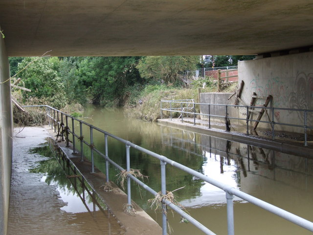
Under the A46
The high water level, the puddles, mud and silt along the walkways, the vegetation around the handrails and the ripped up fencing bear witness to the floods caused by the heavy rain on Friday 20th July 2007.
 Map © Crown Copyright")
TIP: Click the map for more Large scale mapping
- Grid Square
- SP0239, 23 images (more nearby 🔍)
- Photographer
- David Luther Thomas (more nearby)
- Date Taken
- Wednesday, 25 July, 2007 (more nearby)
- Submitted
- Friday, 27 July, 2007
- Subject Location
-
OSGB36:
 SP 023 390 [100m precision]
WGS84: 52:3.0009N 1:58.0636W - Camera Location
-
OSGB36: SP 023 391
- View Direction
- South-southeast (about 157 degrees)