2007
NH3273 : Waterfall of Allt Coire nan Laogh
taken 17 years ago, near to Meall an Torcain [hill or Mountain], Highland, Great Britain
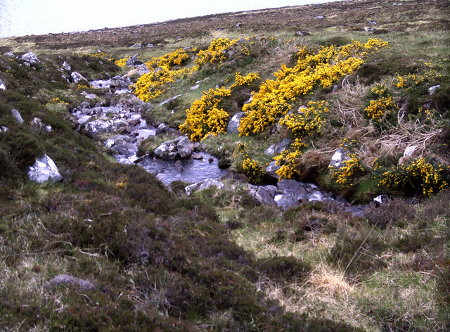
Waterfall of Allt Coire nan Laogh
Picture taken further up, near Coire nan Laogh. Gorse in blossom, a pity You can't smell it now.
NH3173 : Waterfall of Allt Coire nan Laogh
NH3173 : Waterfall of Allt Coire nan Laogh
 Map © Crown Copyright")
TIP: Click the map for more Large scale mapping
- Grid Square
- NH3273, 2 images (more nearby 🔍)
- Photographer
- Anna Zenker - Friedrich (more nearby)
- Date Taken
- Friday, 11 May, 2007 (more nearby)
- Submitted
- Sunday, 29 July, 2007
- Subject Location
-
OSGB36:
 NH 324 737 [100m precision]
WGS84: 57:43.3246N 4:48.9036W - Camera Location
-
OSGB36: NH 324 737
- View Direction
- North-northwest (about 337 degrees)