C3043 : Lenankeel and Lehanbay, Co. Donegal
taken 20 years ago, 4 km SSW of Dunaff, Co Donegal, Ireland
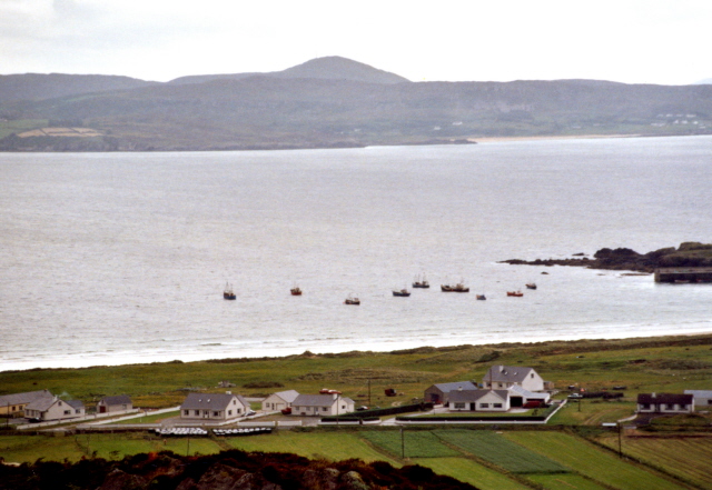
Lenankeel and Lehanbay, Co. Donegal
The village of Lenankeel (I would think) and Lehanbay as seen from the viewpoint of Urrismenagh at the beginning of the road to Mamore Gap in the Urris Hills.
![Creative Commons Licence [Some Rights Reserved]](https://s1.geograph.org.uk/img/somerights20.gif)
|
· Find out How to reuse this image ·
Share:
|
|||||
| Start a discussion on C3043 | Suggest an update to this image | Contact the contributor | |||
Loading map... (JavaScript required)
- Grid Square
- C3043, 14 images (more nearby
 )
)
- Photographer
- Corinna Schleiffer (find more nearby)
- Date Taken
- Friday, 23 July, 2004 (more nearby)
- Submitted
- Friday, 9 September, 2005
- Category
- Village > Village (more nearby)
- Subject Location
-
Irish:
 C 3061 4397 [10m precision]
WGS84: 55:14.5070N 7:31.1728W - Camera Location
-
Irish: C 3177 4416
- View Direction
- WEST (about 270 degrees)
Image Type (about):
cross grid
This page has been viewed about 202 times.
View this location:
KML (Google Earth) ·
Google Maps ·
Bing Maps ·
Geograph Coverage Map ·
More Links for this image
·
Bing Maps ·
Geograph Coverage Map ·
More Links for this image