2016
NX7172 : Fire Tower
taken 8 years ago, 3 km from Merkland, Dumfries And Galloway, Scotland
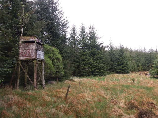
Fire Tower
This wooden tower, marked as a "Fire Tower" on the 1:25,000 OS map, is erected in forestry between Poundland Hill and Planting Hill. It is still in quite good condition and secured by guy wires for stability.
 Map © Crown Copyright")
TIP: Click the map for more Large scale mapping
- Grid Square
- NX7172, 4 images (more nearby 🔍)
- Photographer
- Forrest and Jen (more nearby)
- Date Taken
- Wednesday, 18 May, 2016 (more nearby)
- Submitted
- Monday, 26 September, 2016
- Subject Location
-
OSGB36:
 NX 71981 72975 [1m precision]
WGS84: 55:2.0855N 4:0.2777W - Camera Location
-
OSGB36: NX 71978 72960
- View Direction
- North-northeast (about 22 degrees)