2016
NC4133 : Ben Hee
taken 8 years ago, near to Coire Nam Mang [other Features], Highland, Great Britain
Ben Hee
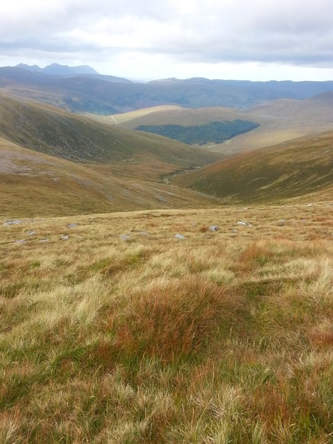
Looking back down to the stalkers' path up the Coir' a' Chruiteir below Ben Hee.
 Map © Crown Copyright")
TIP: Click the map for more Large scale mapping
- Grid Square
- NC4133, 4 images (more nearby 🔍)
- Photographer
- George Middleton (more nearby)
- Date Taken
- Sunday, 25 September, 2016 (more nearby)
- Submitted
- Tuesday, 4 October, 2016
- Subject Location
-
OSGB36:
 NC 4136 3376 [10m precision]
WGS84: 58:15.8287N 4:42.3494W - Camera Location
-
OSGB36: NC 4223 3377
- View Direction
- WEST (about 270 degrees)